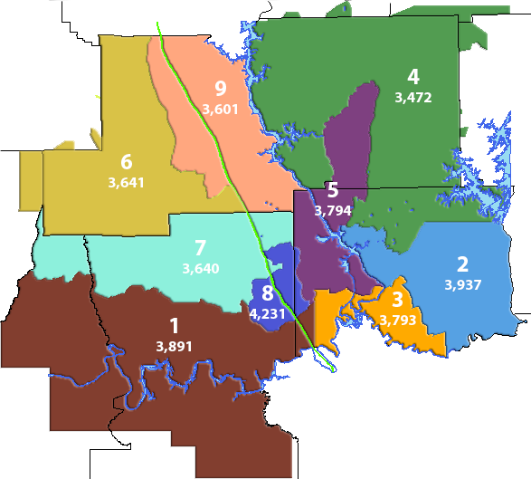
During the January Board meeting, new board district lines were adopted to adjust for high growth areas. The districts are reviewed on an annual basis and if the boundaries need to be altered to correct any substantially inequitable factors, such as a more than two percent disparity between the lowest and highest growth districts, the Board, by resolution, will alter the geographical boundaries (Article IV, Section 4.01 of CAEC’s Bylaws). The last re-districting was done in 2009, and for the first time the number of members exceeded two percent. The maps below reflect the newly adopted changes.To see a listing of the Board members for each district, click here.
New District Map
With number of members per district
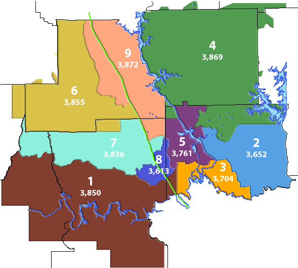
Former District Map
With number of members per district